Note
Go to the end to download the full example code.
Multi-dataset Survey
This example demonstrates the typical workflow for creating a GS file for an AEM survey in its entirety, i.e., the NetCDF file contains all related datasets together, e.g., raw data, processed data, inverted models, and derivative products. Specifically, this survey contains:
Minimally processed (raw) AEM data and raw/processed magnetic data provided by SkyTEM
Fully processed AEM data used as input to inversion
Laterally constrained inverted resistivity models
Point-data estimates of bedrock depth derived from the AEM models
Interpolated magnetic and bedrock depth grids
Note: To make the size of this example more managable, some of the input datasets have been downsampled relative to the source files in the data release referenced below.
Dataset Reference: Minsley, B.J, Bloss, B.R., Hart, D.J., Fitzpatrick, W., Muldoon, M.A., Stewart, E.K., Hunt, R.J., James, S.R., Foks, N.L., and Komiskey, M.J., 2022, Airborne electromagnetic and magnetic survey data, northeast Wisconsin (ver. 1.1, June 2022): U.S. Geological Survey data release, https://doi.org/10.5066/P93SY9LI.
import matplotlib.pyplot as plt
from os.path import join
import numpy as np
import gspy
from gspy import Survey
import xarray as xr
from pprint import pprint
Convert the Skytem csv data to NetCDF
Initialize the Survey
# Path to example files
data_path = '..//data_files//skytem_csv'

# Survey metadata file
metadata = join(data_path, "data//skytem_survey.yml")

# Establish the Survey
survey = Survey.from_dict(metadata)

data_container = survey.gs.add_container('data', **dict(content = "raw and processed data",
                                                        comment = "This is a test"))
1 - Raw Data - Import raw AEM data from CSV-format. Define input data file and associated metadata file
d_data1 = join(data_path, 'data//skytem_contractor_data.csv')
d_supp1 = join(data_path, 'data//skytem_contractor_data.yml')

# Add the raw AEM data as a tabular dataset
data_container.gs.add(key='raw_data', data_filename=d_data1, metadata_file=d_supp1, system=survey.nominal_system)
2 - Processed Data - Import processed AEM data from CSV-format. Define input data file and associated metadata file
d_data2 = join(data_path, 'data//skytem_processed_data.csv')
d_supp2 = join(data_path, 'data//skytem_processed_data.yml')

system = {"skytem_system" : survey["nominal_system"].isel(lm_gate_times=np.s_[1:], hm_gate_times=np.s_[10:]),
          "magnetic_system" : survey["magnetic_system"]}

# Add the processed AEM data as a tabular dataset
pd = data_container.gs.add(key='processed_data', data_filename=d_data2, metadata_file=d_supp2, system=system)
3 - Inverted Models -
# Create a new container for models
model_container = survey.gs.add_container('models', **dict(content = "Inverted models",
                                                          comment = "This is a test"))

# pprint(survey.gs.get_all_attr('standard_name'))
print(survey.gs.tree)

# Import inverted AEM models from CSV-format.
# Define input data file and associated metadata file
m_data3 = join(data_path, 'model//skytem_inverted_models.csv')
m_supp3 = join(data_path, 'model//skytem_inverted_models.yml')

# Add the inverted AEM models as a tabular dataset
model_container.gs.add(key='inverted_models', data_filename=m_data3, metadata_file=m_supp3)
3ae3edf7-e62e-4711-b898-e9e90052ffd7 /survey
ee9f11c3-5b42-4152-bdeb-422a2f3bc2d7 /survey/nominal_system
b056f54b-060e-4a29-82fe-21a8232c401e /survey/magnetic_system
daa9f14e-67de-4f96-bc9d-c905ae613910 /survey/data/raw_data
b29af4c8-1419-41e6-b1fa-74de810c4c8c /survey/data/processed_data
ee9f11c3-5b42-4152-bdeb-422a2f3bc2d7 /survey/data/raw_data/nominal_system
ee9f11c3-5b42-4152-bdeb-422a2f3bc2d7 /survey/data/processed_data/skytem_system
b056f54b-060e-4a29-82fe-21a8232c401e /survey/data/processed_data/magnetic_system
4 - Bedrock Picks - Import AEM-based estimated of depth to bedrock from CSV-format. Define input data file and associated metadata file
d_data4 = join(data_path, 'data//top_dolomite_blocky_lidar.csv')
d_supp4 = join(data_path, 'data//bedrock_picks.yml')

# Add the AEM-based estimated of depth to bedrock as a tabular dataset
data_container.gs.add(key='depth_to_bedrock', data_filename=d_data4, metadata_file=d_supp4)
5 - Derivative Maps -
# We can add arbitrarily named containers to the survey
derived_products = survey.gs.add_container('derived_products', **dict(content = "products derived from other data and models"))

# Import interpolated bedrock and magnetic maps from TIF-format.
# Define input metadata file (which contains the TIF filenames linked to variable names)
m_supp5 = join(data_path, 'data//magnetics_bedrock_picks.yml')

# Add the interpolated maps as a raster dataset
derived_products.gs.add(key='maps', metadata_file=m_supp5)

print(survey.gs.tree)
3ae3edf7-e62e-4711-b898-e9e90052ffd7 /survey
ee9f11c3-5b42-4152-bdeb-422a2f3bc2d7 /survey/nominal_system
b056f54b-060e-4a29-82fe-21a8232c401e /survey/magnetic_system
daa9f14e-67de-4f96-bc9d-c905ae613910 /survey/data/raw_data
b29af4c8-1419-41e6-b1fa-74de810c4c8c /survey/data/processed_data
5a704bb4-fae0-478b-8c87-37198e64befc /survey/data/depth_to_bedrock
c683d125-9f97-4ef3-bbcb-c47e489c2eb8 /survey/models/inverted_models
8cccbac2-825d-4c21-93cb-ee62394b3035 /survey/derived_products/maps
ee9f11c3-5b42-4152-bdeb-422a2f3bc2d7 /survey/data/raw_data/nominal_system
ee9f11c3-5b42-4152-bdeb-422a2f3bc2d7 /survey/data/processed_data/skytem_system
b056f54b-060e-4a29-82fe-21a8232c401e /survey/data/processed_data/magnetic_system
Save to NetCDF file
d_out = join(data_path, 'skytem.nc')
survey.gs.to_netcdf(d_out)
uuid
title
institution
source
history
references
comment
summary
content
created_by
conventions
type
_FillValue
contractor_project_number
contractor
client
survey_type
survey_area_name
state
country
acquisition_start
acquisition_end
survey_attributes_units
coordinates
_FillValue
traverse_line_spacing
traverse_line_direction
tie_line_spacing
tie_line_direction
nominal_terrain_clearance
final_line_kilometers
traverse_line_numbers
repeat_line_numbers
pre_zero_line_numbers
post_zero_line_numbers
coordinates
_FillValue
aircraft
magnetometer
magnetometer_installation
electromagnetic_system
electromagnetic_installation
spectrometer_system
spectrometer_installation
spectrometer_sample_rate
radar_altimeter_system
radar_altimeter_sample_rate
laser_altimeter_system
laser_altimeter_sample_rate
inclinometer_system
inclinometer_sample_rate
navigation_system
navigation_sample_rate
acquisition_system
coordinates
_FillValue
crs_wkt
semi_major_axis
semi_minor_axis
inverse_flattening
reference_ellipsoid_name
longitude_of_prime_meridian
prime_meridian_name
geographic_crs_name
horizontal_datum_name
projected_crs_name
grid_mapping_name
latitude_of_projection_origin
longitude_of_central_meridian
false_easting
false_northing
scale_factor_at_central_meridian
authority
wkid
content
comment
type
_FillValue
crs_wkt
semi_major_axis
semi_minor_axis
inverse_flattening
reference_ellipsoid_name
longitude_of_prime_meridian
prime_meridian_name
geographic_crs_name
horizontal_datum_name
projected_crs_name
grid_mapping_name
latitude_of_projection_origin
longitude_of_central_meridian
false_easting
false_northing
scale_factor_at_central_meridian
authority
wkid
content
type
_FillValue
crs_wkt
semi_major_axis
semi_minor_axis
inverse_flattening
reference_ellipsoid_name
longitude_of_prime_meridian
prime_meridian_name
geographic_crs_name
horizontal_datum_name
projected_crs_name
grid_mapping_name
latitude_of_projection_origin
longitude_of_central_meridian
false_easting
false_northing
scale_factor_at_central_meridian
authority
wkid
uuid
content
comment
type
structure
mode
method
submethod
instrument
property
_FillValue
standard_name
long_name
units
null_value
valid_range
grid_mapping
coordinates
_FillValue
standard_name
long_name
units
null_value
valid_range
grid_mapping
coordinates
_FillValue
standard_name
long_name
units
null_value
valid_range
grid_mapping
coordinates
_FillValue
standard_name
long_name
units
null_value
valid_range
grid_mapping
coordinates
_FillValue
standard_name
long_name
units
null_value
valid_range
grid_mapping
coordinates
_FillValue
standard_name
long_name
units
null_value
valid_range
grid_mapping
coordinates
_FillValue
standard_name
long_name
units
null_value
valid_range
grid_mapping
coordinates
standard_name
long_name
units
null_value
grid_mapping
coordinates
_FillValue
standard_name
long_name
units
null_value
axis
datum
valid_range
grid_mapping
coordinates
_FillValue
standard_name
long_name
units
null_value
valid_range
grid_mapping
coordinates
_FillValue
standard_name
long_name
units
null_value
axis
positive
datum
valid_range
grid_mapping
coordinates
_FillValue
standard_name
long_name
units
null_value
valid_range
grid_mapping
coordinates
_FillValue
standard_name
long_name
units
null_value
axis
valid_range
grid_mapping
coordinates
_FillValue
standard_name
long_name
units
null_value
valid_range
grid_mapping
coordinates
_FillValue
standard_name
long_name
units
null_value
valid_range
grid_mapping
coordinates
_FillValue
standard_name
long_name
units
null_value
valid_range
grid_mapping
coordinates
_FillValue
standard_name
long_name
units
null_value
valid_range
grid_mapping
coordinates
_FillValue
standard_name
long_name
units
null_value
valid_range
grid_mapping
coordinates
_FillValue
standard_name
long_name
units
null_value
em_system_components
valid_range
grid_mapping
coordinates
_FillValue
standard_name
long_name
units
null_value
em_system_components
valid_range
grid_mapping
coordinates
_FillValue
standard_name
long_name
units
null_value
valid_range
grid_mapping
coordinates
_FillValue
standard_name
long_name
units
null_value
valid_range
grid_mapping
coordinates
_FillValue
standard_name
long_name
units
null_value
valid_range
grid_mapping
coordinates
standard_name
long_name
units
null_value
valid_range
grid_mapping
coordinates
_FillValue
standard_name
long_name
units
null_value
em_system_components
valid_range
grid_mapping
coordinates
_FillValue
standard_name
long_name
units
null_value
em_system_components
valid_range
grid_mapping
coordinates
_FillValue
standard_name
long_name
units
null_value
valid_range
grid_mapping
coordinates
_FillValue
standard_name
long_name
units
null_value
valid_range
grid_mapping
coordinates
_FillValue
standard_name
long_name
units
null_value
valid_range
grid_mapping
coordinates
_FillValue
standard_name
long_name
units
null_value
axis
valid_range
grid_mapping
coordinates
_FillValue
standard_name
long_name
units
null_value
valid_range
grid_mapping
coordinates
_FillValue
standard_name
long_name
units
null_value
valid_range
grid_mapping
coordinates
standard_name
long_name
units
null_value
grid_mapping
coordinates
_FillValue
standard_name
long_name
units
null_value
valid_range
grid_mapping
coordinates
_FillValue
crs_wkt
semi_major_axis
semi_minor_axis
inverse_flattening
reference_ellipsoid_name
longitude_of_prime_meridian
prime_meridian_name
geographic_crs_name
horizontal_datum_name
projected_crs_name
grid_mapping_name
latitude_of_projection_origin
longitude_of_central_meridian
false_easting
false_northing
scale_factor_at_central_meridian
authority
wkid
standard_name
long_name
units
null_value
valid_range
grid_mapping
_FillValue
standard_name
long_name
units
null_value
axis
valid_range
grid_mapping
_FillValue
standard_name
long_name
units
null_value
axis
valid_range
grid_mapping
_FillValue
standard_name
long_name
units
null_value
axis
positive
datum
valid_range
grid_mapping
_FillValue
standard_name
long_name
units
null_value
axis
datum
valid_range
grid_mapping
_FillValue
standard_name
long_name
units
null_value
valid_range
grid_mapping
bounds
_FillValue
standard_name
long_name
units
null_value
valid_range
grid_mapping
bounds
uuid
content
comment
type
structure
mode
method
submethod
instrument
property
standard_name
long_name
units
null_value
valid_range
grid_mapping
coordinates
_FillValue
standard_name
long_name
units
null_value
valid_range
grid_mapping
coordinates
_FillValue
standard_name
long_name
units
null_value
axis
valid_range
grid_mapping
coordinates
_FillValue
standard_name
long_name
units
null_value
axis
valid_range
grid_mapping
coordinates
_FillValue
standard_name
long_name
units
null_value
axis
datum
valid_range
grid_mapping
coordinates
_FillValue
standard_name
long_name
units
null_value
valid_range
grid_mapping
coordinates
_FillValue
standard_name
long_name
units
null_value
axis
positive
datum
valid_range
grid_mapping
coordinates
_FillValue
standard_name
long_name
units
null_value
valid_range
grid_mapping
coordinates
_FillValue
standard_name
long_name
units
null_value
valid_range
grid_mapping
coordinates
_FillValue
standard_name
long_name
units
null_value
em_system_components
valid_range
grid_mapping
coordinates
_FillValue
standard_name
long_name
units
null_value
valid_range
grid_mapping
coordinates
_FillValue
standard_name
long_name
units
null_value
em_system_components
valid_range
grid_mapping
coordinates
_FillValue
standard_name
long_name
units
null_value
valid_range
grid_mapping
coordinates
_FillValue
standard_name
long_name
units
null_value
valid_range
grid_mapping
coordinates
_FillValue
standard_name
long_name
units
null_value
valid_range
grid_mapping
coordinates
_FillValue
standard_name
long_name
units
null_value
valid_range
grid_mapping
coordinates
_FillValue
standard_name
long_name
units
null_value
valid_range
grid_mapping
coordinates
_FillValue
standard_name
long_name
units
null_value
valid_range
grid_mapping
coordinates
_FillValue
standard_name
long_name
units
null_value
valid_range
grid_mapping
coordinates
_FillValue
standard_name
long_name
units
null_value
valid_range
grid_mapping
coordinates
_FillValue
standard_name
long_name
units
null_value
valid_range
grid_mapping
coordinates
_FillValue
crs_wkt
semi_major_axis
semi_minor_axis
inverse_flattening
reference_ellipsoid_name
longitude_of_prime_meridian
prime_meridian_name
geographic_crs_name
horizontal_datum_name
projected_crs_name
grid_mapping_name
latitude_of_projection_origin
longitude_of_central_meridian
false_easting
false_northing
scale_factor_at_central_meridian
authority
wkid
standard_name
long_name
units
null_value
valid_range
grid_mapping
_FillValue
standard_name
long_name
units
null_value
axis
valid_range
grid_mapping
_FillValue
standard_name
long_name
units
null_value
axis
valid_range
grid_mapping
_FillValue
standard_name
long_name
units
null_value
axis
positive
datum
valid_range
grid_mapping
_FillValue
standard_name
long_name
units
null_value
axis
datum
valid_range
grid_mapping
_FillValue
standard_name
long_name
units
null_value
valid_range
grid_mapping
bounds
_FillValue
standard_name
long_name
units
null_value
valid_range
grid_mapping
bounds
uuid
content
comment
type
structure
mode
method
submethod
instrument
property
standard_name
long_name
units
null_value
valid_range
grid_mapping
coordinates
_FillValue
standard_name
long_name
units
null_value
axis
valid_range
grid_mapping
coordinates
_FillValue
standard_name
long_name
units
null_value
axis
valid_range
grid_mapping
coordinates
_FillValue
standard_name
long_name
units
null_value
valid_range
grid_mapping
coordinates
_FillValue
standard_name
long_name
units
null_value
valid_range
grid_mapping
coordinates
standard_name
long_name
units
null_value
valid_range
grid_mapping
coordinates
standard_name
long_name
units
format
null_value
grid_mapping
coordinates
_FillValue
crs_wkt
semi_major_axis
semi_minor_axis
inverse_flattening
reference_ellipsoid_name
longitude_of_prime_meridian
prime_meridian_name
geographic_crs_name
horizontal_datum_name
projected_crs_name
grid_mapping_name
latitude_of_projection_origin
longitude_of_central_meridian
false_easting
false_northing
scale_factor_at_central_meridian
authority
wkid
standard_name
long_name
units
null_value
valid_range
grid_mapping
_FillValue
standard_name
long_name
units
null_value
axis
valid_range
grid_mapping
_FillValue
standard_name
long_name
units
null_value
axis
valid_range
grid_mapping
uuid
content
comment
type
structure
mode
method
submethod
instrument
property
_FillValue
standard_name
long_name
null_value
valid_range
grid_mapping
coordinates
standard_name
long_name
units
null_value
valid_range
grid_mapping
coordinates
standard_name
long_name
units
null_value
valid_range
grid_mapping
coordinates
_FillValue
standard_name
long_name
units
null_value
axis
valid_range
grid_mapping
coordinates
_FillValue
standard_name
long_name
units
null_value
axis
valid_range
grid_mapping
coordinates
_FillValue
standard_name
long_name
units
null_value
axis
datum
valid_range
grid_mapping
coordinates
standard_name
long_name
units
null_value
valid_range
grid_mapping
coordinates
_FillValue
standard_name
long_name
units
null_value
axis
positive
datum
valid_range
grid_mapping
coordinates
_FillValue
standard_name
long_name
units
null_value
valid_range
grid_mapping
coordinates
_FillValue
standard_name
long_name
units
null_value
valid_range
grid_mapping
coordinates
_FillValue
standard_name
long_name
units
null_value
valid_range
grid_mapping
coordinates
_FillValue
standard_name
long_name
units
null_value
valid_range
grid_mapping
coordinates
standard_name
long_name
units
null_value
valid_range
grid_mapping
coordinates
_FillValue
standard_name
long_name
units
null_value
valid_range
grid_mapping
coordinates
_FillValue
standard_name
long_name
units
null_value
valid_range
grid_mapping
coordinates
_FillValue
standard_name
long_name
units
null_value
valid_range
grid_mapping
coordinates
_FillValue
standard_name
long_name
units
null_value
valid_range
grid_mapping
coordinates
_FillValue
standard_name
long_name
units
null_value
valid_range
grid_mapping
coordinates
_FillValue
standard_name
long_name
units
null_value
valid_range
grid_mapping
coordinates
_FillValue
standard_name
long_name
units
null_value
valid_range
grid_mapping
coordinates
_FillValue
standard_name
long_name
units
null_value
valid_range
grid_mapping
coordinates
standard_name
long_name
units
null_value
valid_range
grid_mapping
coordinates
_FillValue
crs_wkt
semi_major_axis
semi_minor_axis
inverse_flattening
reference_ellipsoid_name
longitude_of_prime_meridian
prime_meridian_name
geographic_crs_name
horizontal_datum_name
projected_crs_name
grid_mapping_name
latitude_of_projection_origin
longitude_of_central_meridian
false_easting
false_northing
scale_factor_at_central_meridian
authority
wkid
standard_name
long_name
units
null_value
valid_range
grid_mapping
_FillValue
standard_name
long_name
units
null_value
valid_range
grid_mapping
bounds
standard_name
long_name
units
null_value
valid_range
grid_mapping
_FillValue
standard_name
long_name
units
null_value
axis
valid_range
grid_mapping
_FillValue
standard_name
long_name
units
null_value
axis
valid_range
grid_mapping
_FillValue
standard_name
long_name
units
null_value
axis
positive
datum
valid_range
grid_mapping
_FillValue
standard_name
long_name
units
null_value
axis
datum
valid_range
grid_mapping
uuid
content
comment
type
structure
mode
method
submethod
instrument
property
_FillValue
standard_name
long_name
null_value
valid_range
grid_mapping
coordinates
_FillValue
standard_name
long_name
null_value
valid_range
grid_mapping
coordinates
_FillValue
standard_name
long_name
units
null_value
valid_range
grid_mapping
coordinates
_FillValue
standard_name
long_name
units
null_value
valid_range
grid_mapping
coordinates
_FillValue
standard_name
long_name
units
null_value
valid_range
grid_mapping
coordinates
_FillValue
standard_name
long_name
units
null_value
valid_range
grid_mapping
coordinates
_FillValue
crs_wkt
semi_major_axis
semi_minor_axis
inverse_flattening
reference_ellipsoid_name
longitude_of_prime_meridian
prime_meridian_name
geographic_crs_name
horizontal_datum_name
projected_crs_name
grid_mapping_name
latitude_of_projection_origin
longitude_of_central_meridian
false_easting
false_northing
scale_factor_at_central_meridian
authority
wkid
GeoTransform
_FillValue
standard_name
long_name
units
null_value
axis
valid_range
grid_mapping
bounds
standard_name
long_name
units
null_value
valid_range
grid_mapping
_FillValue
standard_name
long_name
units
null_value
axis
valid_range
grid_mapping
bounds
type
mode
method
submethod
instrument
uuid
name
data_normalized
skytem_skb_gex_available
reference_frame
coil_orientations
_FillValue
standard_name
long_name
null_value
valid_range
grid_mapping
_FillValue
standard_name
long_name
units
null_value
valid_range
grid_mapping
_FillValue
standard_name
long_name
units
null_value
valid_range
grid_mapping
_FillValue
standard_name
long_name
null_value
valid_range
grid_mapping
_FillValue
standard_name
long_name
null_value
valid_range
grid_mapping
grid_mapping
valid_range
grid_mapping
_FillValue
valid_range
grid_mapping
valid_range
grid_mapping
grid_mapping
_FillValue
valid_range
grid_mapping
_FillValue
valid_range
grid_mapping
_FillValue
valid_range
grid_mapping
_FillValue
valid_range
grid_mapping
_FillValue
valid_range
grid_mapping
grid_mapping
grid_mapping
grid_mapping
grid_mapping
grid_mapping
_FillValue
valid_range
grid_mapping
_FillValue
valid_range
grid_mapping
_FillValue
units
valid_range
grid_mapping
grid_mapping
grid_mapping
grid_mapping
_FillValue
valid_range
grid_mapping
_FillValue
valid_range
grid_mapping
_FillValue
valid_range
grid_mapping
grid_mapping
grid_mapping
_FillValue
standard_name
long_name
units
null_value
valid_range
grid_mapping
bounds
standard_name
long_name
units
null_value
valid_range
grid_mapping
standard_name
long_name
units
null_value
valid_range
grid_mapping
bounds
standard_name
long_name
units
null_value
valid_range
grid_mapping
bounds
standard_name
long_name
units
null_value
valid_range
grid_mapping
_FillValue
long_name
null_value
units
standard_name
valid_range
grid_mapping
_FillValue
long_name
null_value
units
standard_name
valid_range
grid_mapping
standard_name
long_name
units
null_value
valid_range
grid_mapping
standard_name
long_name
units
null_value
valid_range
grid_mapping
type
mode
method
submethod
instrument
uuid
name
_FillValue
grid_mapping
_FillValue
grid_mapping
The gspy goal is to have the complete survey in a single file. However, we can also save containers or datasets separately.
data_container.gs.to_netcdf(join(data_path, 'test_datacontainer.nc'))
content
comment
type
_FillValue
crs_wkt
semi_major_axis
semi_minor_axis
inverse_flattening
reference_ellipsoid_name
longitude_of_prime_meridian
prime_meridian_name
geographic_crs_name
horizontal_datum_name
projected_crs_name
grid_mapping_name
latitude_of_projection_origin
longitude_of_central_meridian
false_easting
false_northing
scale_factor_at_central_meridian
authority
wkid
uuid
content
comment
type
structure
mode
method
submethod
instrument
property
_FillValue
standard_name
long_name
units
null_value
valid_range
grid_mapping
coordinates
_FillValue
standard_name
long_name
units
null_value
valid_range
grid_mapping
coordinates
_FillValue
standard_name
long_name
units
null_value
valid_range
grid_mapping
coordinates
_FillValue
standard_name
long_name
units
null_value
valid_range
grid_mapping
coordinates
_FillValue
standard_name
long_name
units
null_value
valid_range
grid_mapping
coordinates
_FillValue
standard_name
long_name
units
null_value
valid_range
grid_mapping
coordinates
_FillValue
standard_name
long_name
units
null_value
valid_range
grid_mapping
coordinates
standard_name
long_name
units
null_value
grid_mapping
coordinates
_FillValue
standard_name
long_name
units
null_value
axis
datum
valid_range
grid_mapping
coordinates
_FillValue
standard_name
long_name
units
null_value
valid_range
grid_mapping
coordinates
_FillValue
standard_name
long_name
units
null_value
axis
positive
datum
valid_range
grid_mapping
coordinates
_FillValue
standard_name
long_name
units
null_value
valid_range
grid_mapping
coordinates
_FillValue
standard_name
long_name
units
null_value
axis
valid_range
grid_mapping
coordinates
_FillValue
standard_name
long_name
units
null_value
valid_range
grid_mapping
coordinates
_FillValue
standard_name
long_name
units
null_value
valid_range
grid_mapping
coordinates
_FillValue
standard_name
long_name
units
null_value
valid_range
grid_mapping
coordinates
_FillValue
standard_name
long_name
units
null_value
valid_range
grid_mapping
coordinates
_FillValue
standard_name
long_name
units
null_value
valid_range
grid_mapping
coordinates
_FillValue
standard_name
long_name
units
null_value
em_system_components
valid_range
grid_mapping
coordinates
_FillValue
standard_name
long_name
units
null_value
em_system_components
valid_range
grid_mapping
coordinates
_FillValue
standard_name
long_name
units
null_value
valid_range
grid_mapping
coordinates
_FillValue
standard_name
long_name
units
null_value
valid_range
grid_mapping
coordinates
_FillValue
standard_name
long_name
units
null_value
valid_range
grid_mapping
coordinates
standard_name
long_name
units
null_value
valid_range
grid_mapping
coordinates
_FillValue
standard_name
long_name
units
null_value
em_system_components
valid_range
grid_mapping
coordinates
_FillValue
standard_name
long_name
units
null_value
em_system_components
valid_range
grid_mapping
coordinates
_FillValue
standard_name
long_name
units
null_value
valid_range
grid_mapping
coordinates
_FillValue
standard_name
long_name
units
null_value
valid_range
grid_mapping
coordinates
_FillValue
standard_name
long_name
units
null_value
valid_range
grid_mapping
coordinates
_FillValue
standard_name
long_name
units
null_value
axis
valid_range
grid_mapping
coordinates
_FillValue
standard_name
long_name
units
null_value
valid_range
grid_mapping
coordinates
_FillValue
standard_name
long_name
units
null_value
valid_range
grid_mapping
coordinates
standard_name
long_name
units
null_value
grid_mapping
coordinates
_FillValue
standard_name
long_name
units
null_value
valid_range
grid_mapping
coordinates
_FillValue
crs_wkt
semi_major_axis
semi_minor_axis
inverse_flattening
reference_ellipsoid_name
longitude_of_prime_meridian
prime_meridian_name
geographic_crs_name
horizontal_datum_name
projected_crs_name
grid_mapping_name
latitude_of_projection_origin
longitude_of_central_meridian
false_easting
false_northing
scale_factor_at_central_meridian
authority
wkid
standard_name
long_name
units
null_value
valid_range
grid_mapping
_FillValue
standard_name
long_name
units
null_value
axis
valid_range
grid_mapping
_FillValue
standard_name
long_name
units
null_value
axis
valid_range
grid_mapping
_FillValue
standard_name
long_name
units
null_value
axis
positive
datum
valid_range
grid_mapping
_FillValue
standard_name
long_name
units
null_value
axis
datum
valid_range
grid_mapping
_FillValue
standard_name
long_name
units
null_value
valid_range
grid_mapping
bounds
_FillValue
standard_name
long_name
units
null_value
valid_range
grid_mapping
bounds
uuid
content
comment
type
structure
mode
method
submethod
instrument
property
standard_name
long_name
units
null_value
valid_range
grid_mapping
coordinates
_FillValue
standard_name
long_name
units
null_value
valid_range
grid_mapping
coordinates
_FillValue
standard_name
long_name
units
null_value
axis
valid_range
grid_mapping
coordinates
_FillValue
standard_name
long_name
units
null_value
axis
valid_range
grid_mapping
coordinates
_FillValue
standard_name
long_name
units
null_value
axis
datum
valid_range
grid_mapping
coordinates
_FillValue
standard_name
long_name
units
null_value
valid_range
grid_mapping
coordinates
_FillValue
standard_name
long_name
units
null_value
axis
positive
datum
valid_range
grid_mapping
coordinates
_FillValue
standard_name
long_name
units
null_value
valid_range
grid_mapping
coordinates
_FillValue
standard_name
long_name
units
null_value
valid_range
grid_mapping
coordinates
_FillValue
standard_name
long_name
units
null_value
em_system_components
valid_range
grid_mapping
coordinates
_FillValue
standard_name
long_name
units
null_value
valid_range
grid_mapping
coordinates
_FillValue
standard_name
long_name
units
null_value
em_system_components
valid_range
grid_mapping
coordinates
_FillValue
standard_name
long_name
units
null_value
valid_range
grid_mapping
coordinates
_FillValue
standard_name
long_name
units
null_value
valid_range
grid_mapping
coordinates
_FillValue
standard_name
long_name
units
null_value
valid_range
grid_mapping
coordinates
_FillValue
standard_name
long_name
units
null_value
valid_range
grid_mapping
coordinates
_FillValue
standard_name
long_name
units
null_value
valid_range
grid_mapping
coordinates
_FillValue
standard_name
long_name
units
null_value
valid_range
grid_mapping
coordinates
_FillValue
standard_name
long_name
units
null_value
valid_range
grid_mapping
coordinates
_FillValue
standard_name
long_name
units
null_value
valid_range
grid_mapping
coordinates
_FillValue
standard_name
long_name
units
null_value
valid_range
grid_mapping
coordinates
_FillValue
crs_wkt
semi_major_axis
semi_minor_axis
inverse_flattening
reference_ellipsoid_name
longitude_of_prime_meridian
prime_meridian_name
geographic_crs_name
horizontal_datum_name
projected_crs_name
grid_mapping_name
latitude_of_projection_origin
longitude_of_central_meridian
false_easting
false_northing
scale_factor_at_central_meridian
authority
wkid
standard_name
long_name
units
null_value
valid_range
grid_mapping
_FillValue
standard_name
long_name
units
null_value
axis
valid_range
grid_mapping
_FillValue
standard_name
long_name
units
null_value
axis
valid_range
grid_mapping
_FillValue
standard_name
long_name
units
null_value
axis
positive
datum
valid_range
grid_mapping
_FillValue
standard_name
long_name
units
null_value
axis
datum
valid_range
grid_mapping
_FillValue
standard_name
long_name
units
null_value
valid_range
grid_mapping
bounds
_FillValue
standard_name
long_name
units
null_value
valid_range
grid_mapping
bounds
uuid
content
comment
type
structure
mode
method
submethod
instrument
property
standard_name
long_name
units
null_value
valid_range
grid_mapping
coordinates
_FillValue
standard_name
long_name
units
null_value
axis
valid_range
grid_mapping
coordinates
_FillValue
standard_name
long_name
units
null_value
axis
valid_range
grid_mapping
coordinates
_FillValue
standard_name
long_name
units
null_value
valid_range
grid_mapping
coordinates
_FillValue
standard_name
long_name
units
null_value
valid_range
grid_mapping
coordinates
standard_name
long_name
units
null_value
valid_range
grid_mapping
coordinates
standard_name
long_name
units
format
null_value
grid_mapping
coordinates
_FillValue
crs_wkt
semi_major_axis
semi_minor_axis
inverse_flattening
reference_ellipsoid_name
longitude_of_prime_meridian
prime_meridian_name
geographic_crs_name
horizontal_datum_name
projected_crs_name
grid_mapping_name
latitude_of_projection_origin
longitude_of_central_meridian
false_easting
false_northing
scale_factor_at_central_meridian
authority
wkid
standard_name
long_name
units
null_value
valid_range
grid_mapping
_FillValue
standard_name
long_name
units
null_value
axis
valid_range
grid_mapping
_FillValue
standard_name
long_name
units
null_value
axis
valid_range
grid_mapping
type
mode
method
submethod
instrument
uuid
name
data_normalized
skytem_skb_gex_available
reference_frame
coil_orientations
_FillValue
standard_name
long_name
null_value
valid_range
grid_mapping
_FillValue
standard_name
long_name
units
null_value
valid_range
grid_mapping
_FillValue
standard_name
long_name
units
null_value
valid_range
grid_mapping
_FillValue
standard_name
long_name
null_value
valid_range
grid_mapping
_FillValue
standard_name
long_name
null_value
valid_range
grid_mapping
grid_mapping
valid_range
grid_mapping
_FillValue
valid_range
grid_mapping
valid_range
grid_mapping
grid_mapping
_FillValue
valid_range
grid_mapping
_FillValue
valid_range
grid_mapping
_FillValue
valid_range
grid_mapping
_FillValue
valid_range
grid_mapping
_FillValue
valid_range
grid_mapping
grid_mapping
grid_mapping
grid_mapping
grid_mapping
grid_mapping
_FillValue
valid_range
grid_mapping
_FillValue
valid_range
grid_mapping
_FillValue
units
valid_range
grid_mapping
grid_mapping
grid_mapping
grid_mapping
_FillValue
valid_range
grid_mapping
_FillValue
valid_range
grid_mapping
_FillValue
valid_range
grid_mapping
grid_mapping
grid_mapping
_FillValue
standard_name
long_name
units
null_value
valid_range
grid_mapping
bounds
standard_name
long_name
units
null_value
valid_range
grid_mapping
standard_name
long_name
units
null_value
valid_range
grid_mapping
bounds
standard_name
long_name
units
null_value
valid_range
grid_mapping
bounds
standard_name
long_name
units
null_value
valid_range
grid_mapping
_FillValue
long_name
null_value
units
standard_name
valid_range
grid_mapping
_FillValue
long_name
null_value
units
standard_name
valid_range
grid_mapping
standard_name
long_name
units
null_value
valid_range
grid_mapping
standard_name
long_name
units
null_value
valid_range
grid_mapping
type
mode
method
submethod
instrument
uuid
name
_FillValue
grid_mapping
_FillValue
grid_mapping
Reading back in
new_survey = gspy.open_datatree(d_out)['survey']

print(new_survey)
<xarray.DataTree 'survey'>
Group: /survey
│ Dimensions: ()
│ Coordinates:
│ spatial_ref float64 8B ...
│ Data variables:
│ survey_information float64 8B ...
│ flightline_information float64 8B ...
│ survey_equipment float64 8B ...
│ Attributes:
│ uuid: 3ae3edf7-e62e-4711-b898-e9e90052ffd7
│ title: SkyTEM Airborne Electromagnetic (AEM) Survey, Northeast Wis...
│ institution: USGS Geology, Geophysics, and Geochemistry Science Center
│ source: SkyTEM raw data, USGS processed data and inverted resistivi...
│ history: (1) Data acquisition 01/2021 - 02/2021 by SkyTEM Canada Inc...
│ references: Minsley, Burke J., B.R. Bloss, D.J. Hart, W. Fitzpatrick, M...
│ comment: This dataset includes minimally processed (raw) AEM and raw...
│ summary: Airborne electromagnetic (AEM) and magnetic survey data wer...
│ content: survey information (group /survey), raw data (group /survey...
│ created_by: gspy==2.0.0
│ conventions: CF-1.8, GS-2.0
│ type: survey
├── Group: /survey/data
│ │ Dimensions: ()
│ │ Data variables:
│ │ spatial_ref float64 8B ...
│ │ Attributes:
│ │ content: raw and processed data
│ │ comment: This is a test
│ │ type: container
│ ├── Group: /survey/data/raw_data
│ │ │ Dimensions: (index: 2000, hm_gate_times: 32, lm_gate_times: 28)
│ │ │ Coordinates:
│ │ │ * index (index) int32 8kB 0 1 2 3 4 5 ... 1995 1996 1997 1998 1999
│ │ │ * hm_gate_times (hm_gate_times) float64 256B 2.886e-05 ... 0.003544
│ │ │ * lm_gate_times (lm_gate_times) float64 224B -1.135e-06 ... 0.001394
│ │ │ spatial_ref float64 8B ...
│ │ │ x (index) float64 16kB ...
│ │ │ y (index) float64 16kB ...
│ │ │ z (index) float64 16kB ...
│ │ │ t (index) float64 16kB ...
│ │ │ Data variables: (12/34)
│ │ │ _60hz_intensity (index) float64 16kB ...
│ │ │ alt (index) float64 16kB ...
│ │ │ anglex (index) float64 16kB ...
│ │ │ angley (index) float64 16kB ...
│ │ │ base_mag (index) float64 16kB ...
│ │ │ curr_hm (index) float64 16kB ...
│ │ │ ... ...
│ │ │ mag_raw (index) float64 16kB ...
│ │ │ n_nad83 (index) float64 16kB ...
│ │ │ n_wgs84 (index) float64 16kB ...
│ │ │ rmf (index) float64 16kB ...
│ │ │ time (index) <U8 64kB ...
│ │ │ tmi (index) float64 16kB ...
│ │ │ Attributes:
│ │ │ uuid: daa9f14e-67de-4f96-bc9d-c905ae613910
│ │ │ content: raw data
│ │ │ comment: This dataset includes minimally processed (raw) AEM and raw/...
│ │ │ type: data
│ │ │ structure: tabular
│ │ │ mode: airborne
│ │ │ method: electromagnetic
│ │ │ submethod: time domain
│ │ │ instrument: skytem
│ │ │ property:
│ │ └── Group: /survey/data/raw_data/nominal_system
│ │ Dimensions: (gate_times: 22, nv: 2,
│ │ lm_gate_times: 28,
│ │ hm_gate_times: 32,
│ │ n_loop_vertices: 8, xyz: 3,
│ │ n_transmitter: 2,
│ │ transmitter_lm_waveform_time: 21,
│ │ transmitter_hm_waveform_time: 36,
│ │ n_receiver: 2, n_component: 4)
│ │ Coordinates:
│ │ * gate_times (gate_times) float64 176B 5....
│ │ * nv (nv) int64 16B 0 1
│ │ * n_loop_vertices (n_loop_vertices) int64 64B ...
│ │ * xyz (xyz) int64 24B 0 1 2
│ │ * n_transmitter (n_transmitter) int64 16B 0 1
│ │ * transmitter_lm_waveform_time (transmitter_lm_waveform_time) float64 168B ...
│ │ * transmitter_hm_waveform_time (transmitter_hm_waveform_time) float64 288B ...
│ │ * n_receiver (n_receiver) int64 16B 0 1
│ │ * n_component (n_component) int64 32B 0 1 2 3
│ │ Data variables: (12/31)
│ │ gate_times_bnds (gate_times, nv) float64 352B ...
│ │ lm_gate_times_bnds (lm_gate_times, nv) float64 448B ...
│ │ hm_gate_times_bnds (hm_gate_times, nv) float64 512B ...
│ │ n_loop_vertices_bnds (n_loop_vertices, nv) float64 128B ...
│ │ xyz_bnds (xyz, nv) float64 48B ...
│ │ transmitter_label (n_transmitter) <U2 16B ...
│ │ ... ...
│ │ component_receivers (n_component) <U1 16B ...
│ │ component_txrx_dx (n_component) float64 32B ...
│ │ component_txrx_dy (n_component) float64 32B ...
│ │ component_txrx_dz (n_component) float64 32B ...
│ │ component_data_type (n_component) <U4 64B ...
│ │ component_gate_times (n_component) <U13 208B ...
│ │ Attributes:
│ │ type: system
│ │ mode: airborne
│ │ method: electromagnetic
│ │ submethod: time domain
│ │ instrument: skytem 304M
│ │ uuid: ee9f11c3-5b42-4152-bdeb-422a2f3bc2d7
│ │ name: nominal_system
│ │ data_normalized: True
│ │ skytem_skb_gex_available: True
│ │ reference_frame: right-handed positive down
│ │ coil_orientations: X, Z
│ ├── Group: /survey/data/processed_data
│ │ │ Dimensions: (index: 2000, lm_gate_times: 27, hm_gate_times: 22)
│ │ │ Coordinates:
│ │ │ * index (index) int32 8kB 0 1 2 3 4 5 ... 1995 1996 1997 1998 1999
│ │ │ * lm_gate_times (lm_gate_times) float64 216B 3.65e-07 ... 0.001394
│ │ │ * hm_gate_times (hm_gate_times) float64 176B 5.636e-05 ... 0.003544
│ │ │ spatial_ref float64 8B ...
│ │ │ x (index) float64 16kB ...
│ │ │ y (index) float64 16kB ...
│ │ │ z (index) float64 16kB ...
│ │ │ t (index) float64 16kB ...
│ │ │ Data variables: (12/21)
│ │ │ pindex (index) int64 16kB ...
│ │ │ sline_no (index) float64 16kB ...
│ │ │ e_n83wtm (index) float64 16kB ...
│ │ │ n_n83wtm (index) float64 16kB ...
│ │ │ timestamp (index) float64 16kB ...
│ │ │ record (index) float64 16kB ...
│ │ │ ... ...
│ │ │ rx_altitude (index) float64 16kB ...
│ │ │ rx_altitude_std (index) float64 16kB ...
│ │ │ txrx_dx (index) float64 16kB ...
│ │ │ txrx_dy (index) float64 16kB ...
│ │ │ txrx_dz (index) float64 16kB ...
│ │ │ line_no (index) float64 16kB ...
│ │ │ Attributes:
│ │ │ uuid: b29af4c8-1419-41e6-b1fa-74de810c4c8c
│ │ │ content: processed data
│ │ │ comment: This dataset includes processed AEM data produced by USGS
│ │ │ type: data
│ │ │ structure: tabular
│ │ │ mode: airborne
│ │ │ method: electromagnetic
│ │ │ submethod: time domain
│ │ │ instrument: skytem
│ │ │ property:
│ │ ├── Group: /survey/data/processed_data/skytem_system
│ │ │ Dimensions: (gate_times: 22, nv: 2,
│ │ │ lm_gate_times: 27,
│ │ │ hm_gate_times: 22,
│ │ │ n_loop_vertices: 8, xyz: 3,
│ │ │ n_transmitter: 2,
│ │ │ transmitter_lm_waveform_time: 21,
│ │ │ transmitter_hm_waveform_time: 36,
│ │ │ n_receiver: 2, n_component: 4)
│ │ │ Coordinates:
│ │ │ * gate_times (gate_times) float64 176B 5....
│ │ │ * nv (nv) int64 16B 0 1
│ │ │ * n_loop_vertices (n_loop_vertices) int64 64B ...
│ │ │ * xyz (xyz) int64 24B 0 1 2
│ │ │ * n_transmitter (n_transmitter) int64 16B 0 1
│ │ │ * transmitter_lm_waveform_time (transmitter_lm_waveform_time) float64 168B ...
│ │ │ * transmitter_hm_waveform_time (transmitter_hm_waveform_time) float64 288B ...
│ │ │ * n_receiver (n_receiver) int64 16B 0 1
│ │ │ * n_component (n_component) int64 32B 0 1 2 3
│ │ │ Data variables: (12/31)
│ │ │ gate_times_bnds (gate_times, nv) float64 352B ...
│ │ │ lm_gate_times_bnds (lm_gate_times, nv) float64 432B ...
│ │ │ hm_gate_times_bnds (hm_gate_times, nv) float64 352B ...
│ │ │ n_loop_vertices_bnds (n_loop_vertices, nv) float64 128B ...
│ │ │ xyz_bnds (xyz, nv) float64 48B ...
│ │ │ transmitter_label (n_transmitter) <U2 16B ...
│ │ │ ... ...
│ │ │ component_receivers (n_component) <U1 16B ...
│ │ │ component_txrx_dx (n_component) float64 32B ...
│ │ │ component_txrx_dy (n_component) float64 32B ...
│ │ │ component_txrx_dz (n_component) float64 32B ...
│ │ │ component_data_type (n_component) <U4 64B ...
│ │ │ component_gate_times (n_component) <U13 208B ...
│ │ │ Attributes:
│ │ │ type: system
│ │ │ mode: airborne
│ │ │ method: electromagnetic
│ │ │ submethod: time domain
│ │ │ instrument: skytem 304M
│ │ │ uuid: ee9f11c3-5b42-4152-bdeb-422a2f3bc2d7
│ │ │ name: nominal_system
│ │ │ data_normalized: True
│ │ │ skytem_skb_gex_available: True
│ │ │ reference_frame: right-handed positive down
│ │ │ coil_orientations: X, Z
│ │ └── Group: /survey/data/processed_data/magnetic_system
│ │ Dimensions: (dim_0: 1)
│ │ Dimensions without coordinates: dim_0
│ │ Data variables:
│ │ sample_rate (dim_0) float64 8B ...
│ │ resolution (dim_0) float64 8B ...
│ │ Attributes:
│ │ type: system
│ │ mode: airborne
│ │ method: magnetic
│ │ submethod: total field
│ │ instrument: cesium vapour
│ │ uuid: b056f54b-060e-4a29-82fe-21a8232c401e
│ │ name: magnetic_system
│ └── Group: /survey/data/depth_to_bedrock
│ Dimensions: (index: 82864)
│ Coordinates:
│ * index (index) int32 331kB 0 1 2 3 4 ... 82860 82861 82862 82863
│ spatial_ref float64 8B ...
│ x (index) float64 663kB ...
│ y (index) float64 663kB ...
│ Data variables:
│ id (index) int64 663kB ...
│ e_n83wtm (index) float64 663kB ...
│ n_n83wtm (index) float64 663kB ...
│ br_elevation (index) float64 663kB ...
│ zstd (index) float64 663kB ...
│ origintype (index) int64 663kB ...
│ editdate (index) <U15 5MB ...
│ Attributes:
│ uuid: 5a704bb4-fae0-478b-8c87-37198e64befc
│ content: bedrock elevation points
│ comment: This dataset includes AEM-derived point estimates of the ele...
│ type: data
│ structure: tabular
│ mode:
│ method:
│ submethod:
│ instrument:
│ property:
├── Group: /survey/models
│ │ Dimensions: ()
│ │ Data variables:
│ │ spatial_ref float64 8B ...
│ │ Attributes:
│ │ content: Inverted models
│ │ comment: This is a test
│ │ type: container
│ └── Group: /survey/models/inverted_models
│ Dimensions: (layer_depth: 40, nv: 2, index: 2000)
│ Coordinates:
│ * layer_depth (layer_depth) float64 320B 0.375 1.16 2.02 ... 262.6 343.8
│ * nv (nv) int64 16B 0 1
│ * index (index) int32 8kB 0 1 2 3 4 5 ... 1995 1996 1997 1998 1999
│ spatial_ref float64 8B ...
│ x (index) float64 16kB ...
│ y (index) float64 16kB ...
│ z (index) float64 16kB ...
│ t (index) float64 16kB ...
│ Data variables: (12/22)
│ layer_depth_bnds (layer_depth, nv) float64 640B ...
│ pindex (index) int64 16kB ...
│ sline_no (index) int64 16kB ...
│ e_n83wtm (index) float64 16kB ...
│ n_n83wtm (index) float64 16kB ...
│ timestamp (index) float64 16kB ...
│ ... ...
│ RHO_I_STD (index, layer_depth) float64 640kB ...
│ DEP_TOP (index, layer_depth) float64 640kB ...
│ DEP_BOT (index, layer_depth) float64 640kB ...
│ doi_conservative (index) float64 16kB ...
│ doi_standard (index) float64 16kB ...
│ line_no (index) int64 16kB ...
│ Attributes:
│ uuid: c683d125-9f97-4ef3-bbcb-c47e489c2eb8
│ content: inverted resistivity models
│ comment: This dataset includes inverted resistivity models derived fr...
│ type: model
│ structure: tabular
│ mode: airborne
│ method: electromagnetic
│ submethod: time domain
│ instrument: skytem
│ property: electrical resistivity
└── Group: /survey/derived_products
│ Dimensions: ()
│ Data variables:
│ spatial_ref float64 8B ...
│ Attributes:
│ content: products derived from other data and models
│ type: container
└── Group: /survey/derived_products/maps
Dimensions: (x: 799, nv: 2, y: 1155)
Coordinates:
* x (x) float64 6kB 6.551e+05 6.552e+05 ... 7.349e+05
* nv (nv) int64 16B 0 1
* y (y) float64 9kB 4.953e+05 4.952e+05 ... 3.799e+05
spatial_ref float64 8B ...
Data variables:
x_bnds (x, nv) float64 13kB ...
y_bnds (y, nv) float64 18kB ...
magnetic_tmi (y, x) float64 7MB ...
magnetic_rmf (y, x) float64 7MB ...
bedrock_top_elevation (y, x) float32 4MB ...
bedrock_depth (y, x) float32 4MB ...
Attributes:
uuid: 8cccbac2-825d-4c21-93cb-ee62394b3035
content: gridded magnetic and bedrock maps
comment: This dataset includes AEM-derived estimates of the elevation...
type: data
structure: raster
mode: airborne
method: electromagnetic
submethod: time domain
instrument: skytem
property: ['magnetic', 'depth to bedrock']
Plotting
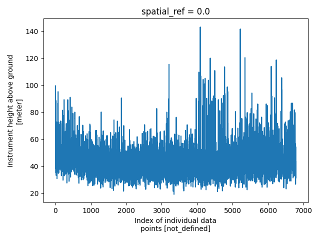
plt.figure()
new_survey['data']['raw_data']['height'].plot()
plt.tight_layout()
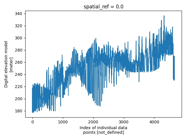
pd = new_survey['data']['processed_data']
plt.figure()
pd['elevation'].plot()
plt.tight_layout()
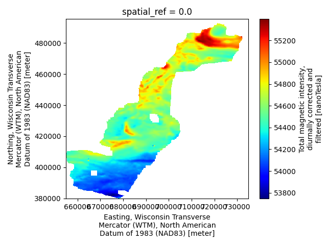
m = new_survey['derived_products']['maps']
plt.figure()
m['magnetic_tmi'].plot(cmap='jet')
plt.tight_layout()
plt.show()
Total running time of the script: (0 minutes 1.183 seconds)